Agricultural Survey
In a fraction of the time it would take to scout on foot, Gtg Geo Technicals Solutions Pvt. Ltd. deliver an instant shot of the field. Hundreds of hectares can be covered in a single flight, allowing for the detection and identification of different types of crop stress. Farmers may use GTG Geo Technical Solutions Pvt Ltd to determine exact field sizes, classify crop varieties, and plan harvesting. Over 35 drone start-ups in India are aiming to improve the technology standards and lower the costs of farm drones
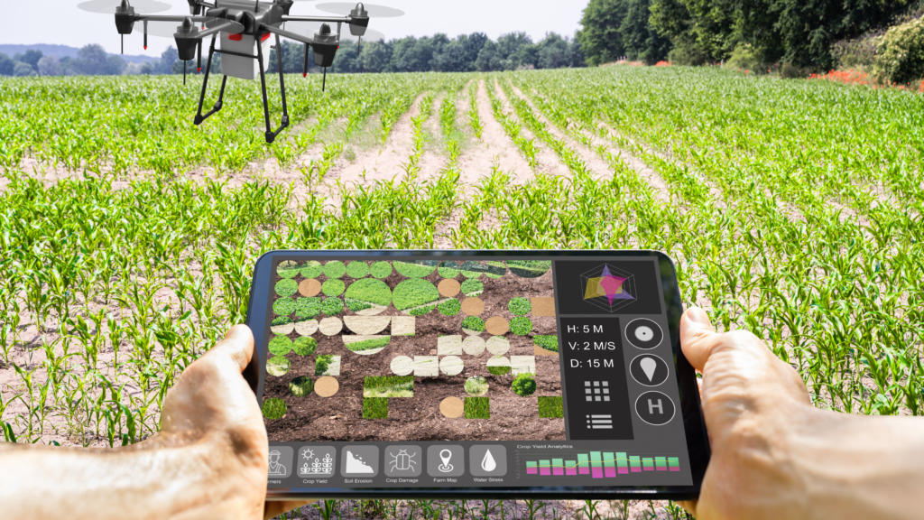
In a fraction of the time it would take to scout on foot, Gtg Geo Technicals Solutions Pvt. Ltd. deliver an instant shot of the field. Hundreds of hectares can be covered in a single flight, allowing for the detection and identification of different types of crop stress. Farmers may use GTG Geo Technical Solutions Pvt. Ltd. to determine exact field sizes, classify crop varieties, and plan harvesting. Over 35 drone start-ups in India are aiming to improve the technology standards and lower the costs of farm drones.
Growers, service providers, and agricultural researchers can use Gtg Geo Technicals Solutions Pvt. Ltd. to survey their crops, diagnose stress, develop treatment plans, track plant growth, and more. Crop health concerns can be detected and quantified early on using high-resolution RGB cameras. These helpful information can help you save money on your inputs and increase your yield. Use Gtg Geo Technicals Solutions Pvt. Ltd. data to create prescription maps and plans, which can help you target treatments more effectively and save money. Gain information that can be used in conjunction with other agronomic tools.